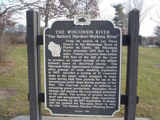
THE WISCONSIN RIVER
`The Nation's Hardest-Working River"
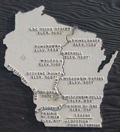
From its source at Lac Vieux Desert to the Mississippi River at Prairie du Chien, the Wisconsin
River descends 1,071 feet in 430
miles. Twenty-six power dams utilize
640 feet of the fall of the river
to produce an annual average of one billion
kilowatt hours of electrical energy. The
Wisconsin Valley Improvement Company, created
after passage of state enabling legislation
in 1907, operates a system of 21 'reservoir
dams in the upper valley designed to store
water during high flow periods for use in the
downstream power dams during periods of low
flow. The reservoir system, in addition .to
enhancing power production, diminishes flood
damage and enriches the recreational potential
of the valley. The system of private development and management under state regulation,
made possible by the 1907 legislation, is unique
and has enabled the Wisconsin River to earn
the title "The Nation's Hardest-Working River."
Erected 1982
|
|
|